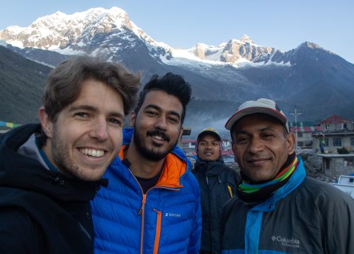
Explore The Worlds

People Don’t Take, Trips Take People

Manaslu Circuit with Nar Phu Valley Trek

Manaslu Conservation Area and Annapurna Conservation Area, Gorkha and Manang Districts, Nepal

From

Duration

21 days

Overview

The most varied and enticing trekking region in Nepal is the Annapurna Region, yet Manaslu Territory lies off the usual trekking path. The trek between these areas provides an exciting nature experience and a variety of delights. To introduce our cherished guests to the mysterious locations of Annapurna and Manaslu region trekking, Manaslu Expert prepared such a lengthy diversion. Manaslu Nar Phu Trek includes the magnificence of all of these exceptional Nepalese trekking locations.Trekking over Manaslu Himal while taking in the stunning Nar and Phu valleys offers wonderful life experiences. It offers an opportunity to learn more about the distinctive standards and traditions of the Tibetan people and is heavily inspired by ethnic Tibetan culture. The hidden valleys of Nar, Phu, upper Manang, and Nyawal village are better explored during treks.

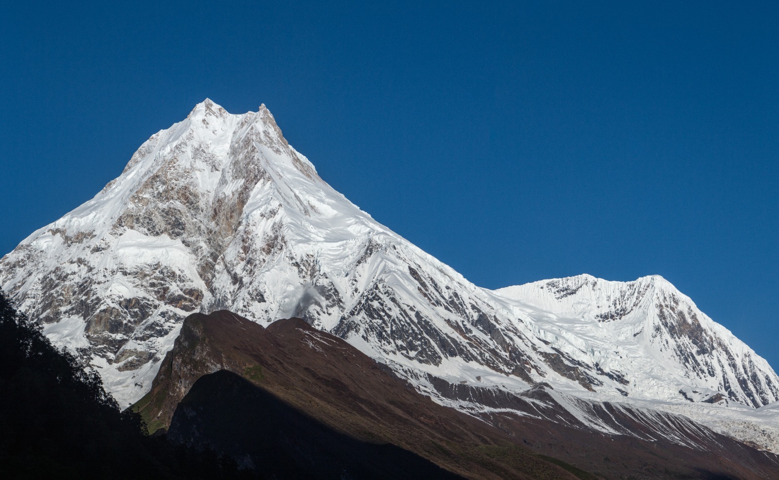
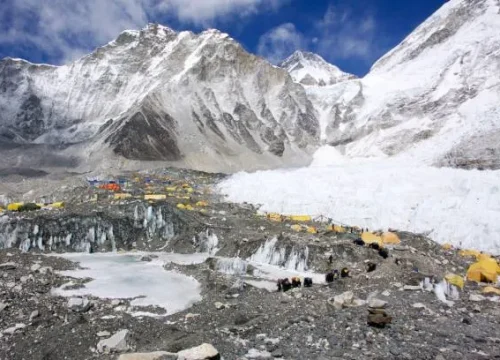
Manaslu, which is sometimes referred to as the “Mountain of the Spirit,” is a mountain in Nepal’s western-central region. Its altitude is 8163 meters (26781 ft.). The term Manaslu derives from the Sanskrit word “Manasa,” which means “Intelligence.” The eight tallest mountains in the world provide uswith incredible life-changing experiences. The Japanese Expedition people made the first ascent of Mount Manaslu on May 9, 1956. They were Gyalzen Norbu and Toshio Imanishi. Even though the area was just opened in 1991, other teams have already examined there.

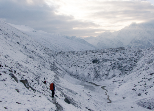
Up till Bhimthang, the route is comparable to the standard Manaslu Circuit Trek. After negotiating the difficult Larke La Pass in the area of Mount Manaslu, trekkers proceed down the Tilje path in the direction of two renowned villages in the Annapurna region. Two villages with Tibetan populations are Nar and Phu.

Along with its breathtaking vistas, Manaslu offers visitors the chance to explore Buddhist temples, Mani walls, and prayer flags, as well as historical arts. One of the best aspects of this walk is the excellent opportunity to thoroughly examine Tibetan traditions and daily life in the isolated valleys of upper Manang. Visit some of Kathmandu’s stunning, artistic, and architectural world heritage sites.

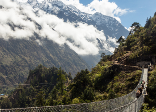
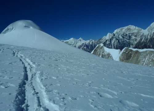
Similarly, hiking through the Manaslu and Nar Phu basins takes us to several glacier valleys and towns that are remarkably unspoiled and uninhabited. We pass a lot of isolated communities like Samagaon and Samdo as well as valleys like Marsyangdi and the Gandaki riverbank. Although Nar and Phu Valley are prohibited places, it is possible to trek there with special authorization. Here, we can discover themagnificent mountain vistas. Mansiri 7187m (23579 ft.), Himalchuli 7893m, Ganesh Himal 7422m (24350 ft.), and Annapurna 8081m (26512 ft.) are a few of them (25895 ft.). as well as Tibetan culture, people, the customs, values, and ceremonies.

Highlights:

  • Remote and adventurous: The trek takes you through a less-traveled region, offering a sense of exploration and adventure.
  • Majestic Manaslu: Witness the stunning beauty of Manaslu, the eighth tallest mountain in the world, standing at 8163 meters.
  • Cultural immersion: Immerse yourself in the unique customs and traditions of the Tibetan people, influenced by Tibetan culture.
  • Buddhist heritage: Explore ancient Buddhist temples, Mani walls, prayer flags, and historical art, revealing the rich religious heritage of the area.
  • Secluded valleys: Trek through isolated glacier valleys and towns, experiencing untouched landscapes.
  • Nar and Phu villages: Visit picturesque Tibetan villages, once restricted areas, now accessible with special authorization.
  • Diverse landscapes: Encounter varied terrains, from high mountain passes to lush green valleys, creating a fulfilling trekking experience.
  • Glacial rivers: Cross numerous glacial rivers like Marsyangdi and Gandaki, enhancing the scenic beauty of the trek.
  • Breathtaking mountain views: Enjoy the sight of Himalchuli, Ganesh Himal, Annapurna, and more, delighting mountaineering enthusiasts.
  • Kathmandu heritage sites: Explore stunning world heritage sites in Kathmandu, adding a cultural dimension to your journey

Best Season

Although Nepal is a tourist hotspot all year round, the ideal times to hike in the Manaslu area are in the spring (March to May) and fall (mid-Sept to mid-Dec). Trekking in the fall is renowned for its bright skies and stunning views of the glittering peaks against the turquoise sky. As December draws to a close, the temperature drops. Any month, with the exception of January, February, June, and July, is suitable for this expedition.

Acclimatization

Despite having excellent physical fitness, any hiker can get altitude sickness while hiking at a high altitude. Giving yourself enough time to properly acclimatize for your hike is crucial. The trekkers will have adequate time to acclimatize thanks to the itinerary’s steady ascent in height, which was devised by Sunrise Adventure Trek. Preventing AMS involves hiking carefully, especially at high altitudes (Acute Mountain Sickness).

Anyone experiencing symptoms such as lightheadedness, palpitations, severe headaches, or loss of appetite will be relocated to a lower altitude right away or, in the case of severe AMS, arrangements will be made for a helicopter rescue, with the customer bearing the cost.

Meals (Breakfast, Lunch, Dinner)

During the Round Manaslu trek, trekkers receive three meals per day (breakfast, lunch, and dinner). They can eat a variety of foods, including traditional Nepali fare and several sorts of international cuisine (Continental, Nepalese, and Indian.). Unlike other trekking organizations.

Manaslu Expert provides trekkers to select their meals from the hotel/lodge menus. Most establishments will offer a set menu if the gathering is too large for the hotels or lodges to serve individual dishes. We use hotels and lodges that provide sanitary, nourishing, and tasty cuisine for trekkers so they have the energy to hike.

Accommodation

In Kathmandu, you will stay in 3-star accommodations. We will be staying in lodges/teahouses along the tour. Lower elevations may have more pleasant and higher-quality teahouses. It should be indicated that the quality of lodging may be lower at higher elevations, with more basic accommodations with the essential amenities.

Travel Insurance

Trekkers must have travel coverage to protect all potential costs, including those resulting from accidents or medical concerns (concludes helicopter rescue, and medical treatment costs). Trekkers must purchase travel insurance by one of the international insurance firms because Nepali insurance companies do not offer travel insurance for foreigners.

Included/Exclude

  • Airport / hotel transfers
  • Jomsom to Pokhara and Pokhara to Kathmandu flights
  • Private vehicle between other destinations for the activities included in the itinerary
  • All accommodation on a double occupancy basis
  • Trekking Permit and TIMS fees
  • All meals during trekking, all breakfasts in Kathmandu and Pokhara, one welcome dinner and one farewell dinner
  • Duffle bag for trekking (to be returned after the trip)
  • Experienced English-speaking trekking guide and a team of porters (one for every two clients) and assistants during trekking
  • Entrance fees and an English-speaking guide for the Kathmandu sightseeing tour
  • Insurance for the trekking guide and porters
  • First aid kit (carried by the trekking guide)
  • International flight, travel insurance, visitor visa fee
  • All optional activities
  • Meals not mentioned (please allow for $80-120 USD for meals not included)
  • Personal trekking gear (available for rent)
  • Personal expenses
  • Drinking water, snacks, hot shower and Wi-Fi during trekking
  • Tips for guides and porters
  • Charges for excessive luggage
  • Any other extra costs due to unforeseen circumstances

Tour Amenities

Accepts Credit Cards
Laundry Service
Outdoor Seating
Reservations
Restaurant
Smoking Allowed

Tour Plan

When you land at Tribhuvan International Airport, a representative from Manaslu Expert transfers you to the hotel and in the evening, you can stroll around Thamel.

We use the Prithvi Highway to travel to Arkhet, which takes about 5 to 6 hours. On the route, there are spectacular views of the Himalayas, terraced fields, sceneries, and native flora and animals. Once more, it takes us 20 minutes to go 6.3 kilometers from Arkhet to SotiKhola. As you go to SotiKhola, you pass under several intriguing bridges and get views of the beautiful Buri Gandaki River.

You will depart from SotiKhola and travel for around 6 hours total to MachhaKhola, which is located at an elevation of 869 meters above sea level. As an approach, you might still prepare to travel a little further to KhorlaBesi (970m). Greater than KhorlaBesi.

Tatopani to Yuru, and again from Yuru to Jagat are all on the route from Machakhola to Jagat. To go to Tatopani, we first cross the "Maccha" and "Khorla" rivers (Hot spring water). Tatopani is located at the base of a cliff along a strenuous route.
This then brings us to YuruPhant and Dobhan, where we can explore the nearby villages. We can see the beautiful Buri Gandaki River near YuruPhant. At a height of 1410 m, it now takes 2 to 3 hours to get from Yuru to Jagat.

We will leave Jagat and proceed by making a protracted descent down a concrete stairway towards the river before making your way uphill to Saguleri. Siringi Himal is visible on the horizon from Saguleri. Once again, a suspension bridge crosses the Budi-Gandaki River as the trail arrives in GhataKhola.
After there, you'll turn toward Philim Village and ascend the slope, passing several teeny-tiny communities including Aga and Lokwa. After leaving Ekle Bhatti, you will eventually set your camp near the village of Deng, accompanied by a steady stroll.

It takes close to 7 to 8 hours to hike from Deng to Ghap. we initially hike upward before crossing the Buri Gandaki River. Exploring the magnificent waterfall and streams that flow down the route is made possible by hiking along with it.
After that, we drive past the wonderful Gurung hamlet and carefully examine how they live their everyday lives according to their cultures and traditions. We eventually made it through the ShringKhola and arrived at Ghap.

You must first climb for around 30 minutes from Ghap to reach the lovely Namrung village. Again, 2 hours of trekking from Nagrung will get you to Lihi. Ligaon is another name for Lihi. The Himal Chuli range and Hinang Gompa are this location's two main draws. After 2.5 hours of hiking and traversing the HinangKhola, we arrive in Lho.
The Gompa, on which we can see more than 150 youngsters receiving education, is the primary draw of Lho. The region, which is on a hillside, features sweeping magnificent views of Manaslu and the other settlements. Moving forward, we traverse Shyala on our way from Leh to Samagaon. Yaks can be seen munching on grass in Shyala.

Samagaon, a stunning village, provides a wonderful Tibetan culture with its distinctive customs and way of life. Samagaon is the excursions' first station and the village closest to the Manaslu Base Camp. We spend the night here to adjust to the altitude and to see the nearby village and historic monasteries.
On this day, we can choose to go to PungGyen Gompa, which offers a beautiful walk, or to Manaslu Base Camp, which is notable for its breathtaking mountain scenery, lakes, and landscapes.

We can reach the upper Buri Gandaki River in the northern portion of the valley by following the trek route from Samagaon to Samdo. Visitors can find mani walls and chortens throughout the trail. You may now discover the village of Samdo, which is close to the Samdo glacier and summit. You come across blue sheep as we stroll down the slope over the region of lush greenery.

Today we will hike along the cliff's edge before crossing the wooden bridge over the Budi Gandaki and starting to climb. You will travel around the SalkaKhola valley, cross two streams, and see the Larke Glacier before returning to LarkePhedi (4460m) and Dharamshala a place for rest for visitors walking around.
The maximum height at which you will sleep is this one. Due to today's short hike, there will be enough time for relaxation and acclimatization.

We leave Dharmasala early in the morning and traverse the Larke Pass. This transports us to a different realm with stunning scenery surrounded by snow-capped mountains. On the route, we pass through several rugged moraines and some beautiful lakes.
Larke Pass may be reached in 4–5 hours. It about three to five hours to drop to the Bhimtang. We visit Salpudanda Glacier on the slick path to Bhimtang. We have a look at Pongkar Lake, which is located alongside Bhimtang Glacier to the west of the path.

You may hike from Bhimtang to Tilje in 6 hours, covering a distance of 2300 meters (7290 feet). The trip through the DudhKhola and bamboo pine trees appears to be straightforward. You will stroll for a few hours after descending a ward and passing through lovely tiny communities. It brings you to the Tibetan population's biggest communities, where you may get a close-up look at their habitat and way of life.

Koto, located at an elevation of 2610 meters (8563 feet), may be reached by foot in about 5 to 6 hours from Tilje. We stroll along the Annapurna Circuit path. As a result, the walk combines breathtaking vistas of Annapurna II and Manaslu Peak with a glimpse into Thanchowk village residents' daily lives. Bagarchap Village is located after we cross the Marsyangdi River on the path.
After that, we travel through a pine forest to Koto, crossing Timing at 2510 meters. As we arrive in Koto, we are treated to breathtaking vistas of the Manaslu, Lamjung, and Annapurna ranges.

Due to the significant distance, they must cover, the trekkers will begin the day as early as possible. To access the Nar and Phu valleys, you must cross the river. The communities close to the Annapurna Circuit are considerably more established than those in the other valleys. However, these valleys are completely undeveloped regions.
The hiking trail runs via lovely forests, little cave sanctuaries, and resting spots for travelers. The path exits the constrained canyon and crosses beneath a sizable cascade. The vistas get larger and the canyon's forests get thinner. The Meta's route requires climbing a challenging slope. The hill provides visitors with breathtaking views of some of the enormous mountain peaks.

Today, we climb to the valley's rim near the river. Bypassing the Chyakhu and Kyang hamlet, one continues on the steep trail through the deserted landscapes. As we make our way lower to the Phu valley, we pass yaks grazing nearby. We get the opportunity to see numerous Tibetan communities along the trail, including Meta, Khampas, Junam, and Chako. We can see the ruins of old forts here as well.

We need enough rest and acclimatization to complete the trek risk-free. Even if you are not tired this day help to adjust you to the current climate of the Himalayas.
We look at the locals who live in this area and observe their various customs, rules, and ways of life, as well as the renowned Lakhang monastery. The Lakhang Monastery is regarded as the oldest monastery in the world. The rest of the day is spent discussing Tibetan languages and customs.

The trekkers must turn around and head back toward Meta before stopping at the Nar Phedi monastery. At Nar Phedi, the monastery is the only place to stay overnight. The sisters in the monastery are incredibly modest and welcoming, and the accommodations are tidy and spotless.
The tourists are welcome to assist them in the kitchen and see them cook on a simple campfire which is a pleasant and magnificent sight to see. You can donateto the upkeep of this lovely and welcoming area in the monastery's modest charity box, which is located outside the entryway.

We ought to make an extra effort than normal because we must travel across an area with an elevation of 5306 m. We have beautiful scenery of the Mountains, including Annapurna I, Gangapurna, Tilicho, and others, from the summit of the pass. Then drop to the stunning Ngwal section of the Annapurna circuit. Ngwal is a stunning village. We can see Mani walls with prayer wheels here.

We trek to Chame from Ngwal at 3540m with unexpected stunning panoramic Himalayas and Tibetan towns. We enter Pisang Settlement by gradually descending; from there, we continue trekking over the Marsyangdi River to approach Chame. Manang district headquarters are in Chame. We will trek for 4 to 5 hours today.

We drive to Chame from Ngwal at a surprising altitude of 3540 m while taking in the scenery of the surrounding Himalayas and Tibetan communities before continuing to Besisahar and Kathmandu. After a beautiful drive, we arrive in Kathmandu.

A representative from Skyway Nepal will drop you at Tribhuwan International Airport for farewell and you can proceed with your departure process inside Airport

Location

Find a route from your location

Related Tours

No reviews yet

Add a Comment

Your email address will not be published.

  • Quality
  • Location
  • Amenities
  • Services
  • Price

Booking Tour

Tour Information

Max Guests

12

Min Age

4

Tour Location

Languages Support